
Aerial Drone Property CGI for Former Garden Centre


Aerial Drone Property CGI Case Study: Transforming a Former Garden Centre into a Clear Development Vision
Aerial drone property CGI has become one of the most effective ways to communicate development proposals, particularly on sites where context is everything. At Charles Roberts Studios, we regularly produce high-quality aerial visualisations that help landowners, developers, architects and planning teams present schemes with far greater clarity than drawings alone can provide. This case study focuses on a former garden centre site and shows how aerial drone CGI was used to illustrate a proposed residential development in a way that was clear, realistic and commercially useful.
The two images created for this project were designed to do much more than simply show a masterplan from above. They were produced to explain how a redundant or underused site could be transformed into an attractive residential setting that felt logical, well integrated and sensitive to the surrounding landscape. By combining drone photography with carefully modelled CGI architecture and landscaping, the visuals allowed viewers to understand the site in a single glance. They could see how the development would sit within the road network, how it would relate to neighbouring properties, and how mature landscape features would help shape the character of the scheme.
On a site such as this, where the existing use had limited visual appeal and the future value depended on a strong vision, aerial CGI became a vital communication tool. It helped replace uncertainty with confidence.
The Site Context
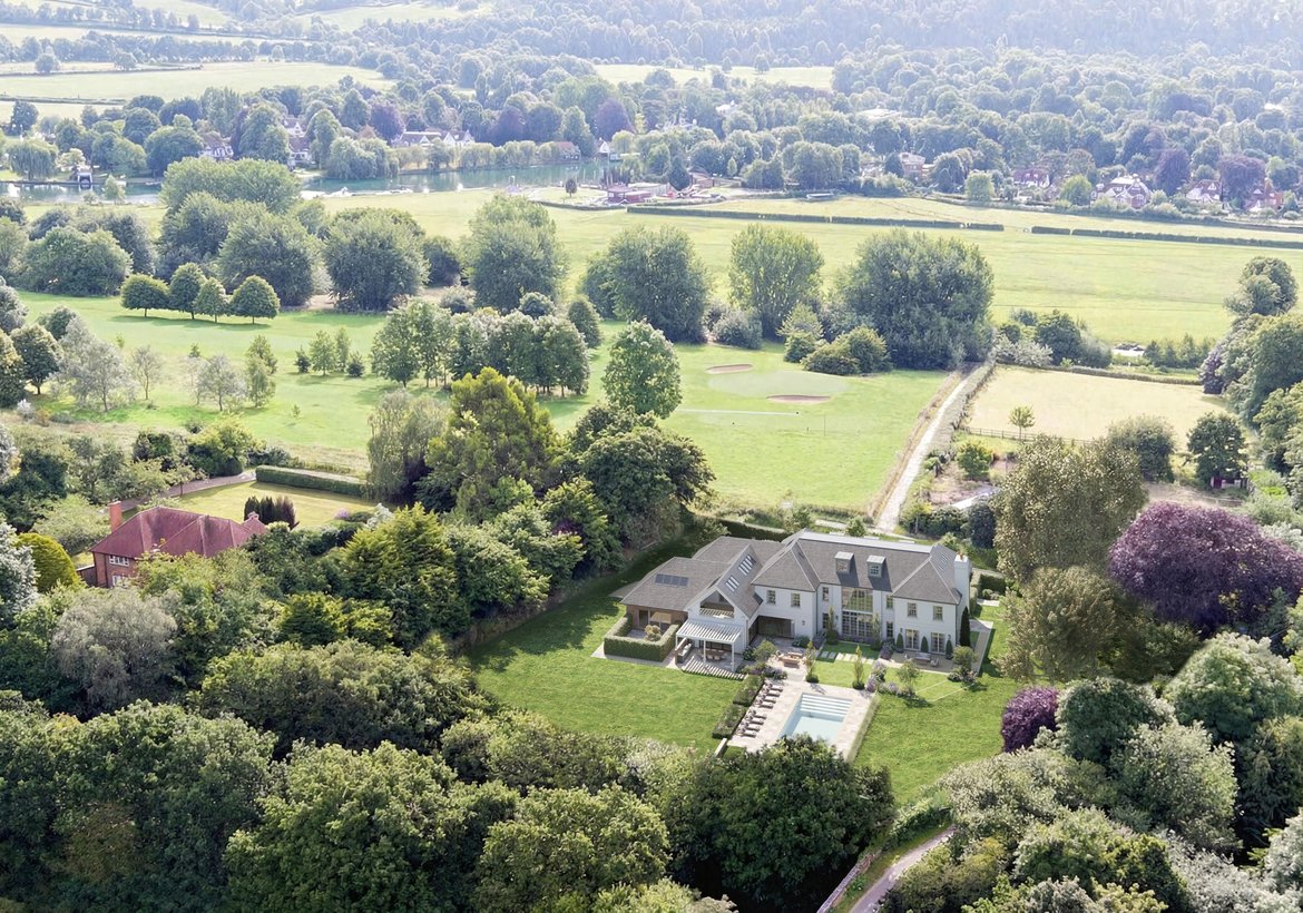
The site was a former garden centre, positioned within a semi-rural setting and surrounded by a mixture of mature trees, open fields, nearby housing and road connections. From ground level, a site like this can often be difficult to fully understand. Existing structures, vegetation and fragmented circulation routes can obscure the bigger picture. That is one of the reasons aerial drone imagery is so valuable. It reveals the full site context immediately.
In this case, the wider setting was a major part of the story. The site sat within an attractive green landscape, with open countryside stretching beyond the immediate boundaries. Nearby residential areas already gave the location a sense of settlement, while the retained vegetation and strong boundary planting created an opportunity for a scheme that felt established rather than exposed. These qualities are not always easy to communicate through plans, elevations or street-level imagery alone. An aerial view, however, captures them naturally.
The former garden centre use also meant the site came with a degree of complexity. Sites like this can often feel visually untidy in their existing condition, with hardstanding, scattered buildings, leftover infrastructure and an unclear sense of arrival. While that may be obvious to those familiar with the site, it is not always easy for external audiences to imagine its future potential. Aerial drone property CGI helps bridge that gap by showing the site not as it is, but as it could become.
The Brief
The brief for this project was to produce compelling aerial views that would communicate the residential potential of the former garden centre site. The client needed visuals that could clearly illustrate the proposed layout, show how the homes would sit within the landscape, and provide a persuasive overview of the development as a whole.
This was not simply about creating an attractive picture. The images needed to be informative. They needed to show the structure of the scheme, the relationship between dwellings and gardens, the movement through the site, the treatment of boundary planting and the overall sense of quality that the finished development would offer. The visuals also needed to feel grounded in reality. Aerial CGI is most effective when it strikes the right balance between aspiration and accuracy. It should enhance understanding without overstating what is proposed.
Because the site had a previous commercial or horticultural use, the CGI also needed to help reframe perceptions. Rather than seeing an old garden centre, viewers needed to see a residential development with coherence, value and a genuine sense of place.
Why Aerial Drone CGI Was the Right Approach
For this type of project, aerial drone property CGI was the ideal solution. Traditional architectural CGI is excellent for showing individual house types, street scenes or key arrival views, but on a larger or more irregular site, it can be difficult to communicate the broader layout without an aerial perspective. A drone-based visual offers a much more complete understanding.
The first major advantage is context. Aerial visuals show exactly where a development sits within its surroundings. That includes nearby roads, neighbouring properties, tree belts, open land and other key landscape features. On this former garden centre site, context mattered enormously because the success of the proposal depended in part on showing how comfortably it would fit within the established pattern of the area.
The second advantage is legibility. From above, viewers can understand the structure of the scheme almost instantly. They can see access points, private plots, shared green space, planting, and the relationship between built form and open landscape. This is especially useful when the audience includes non-specialists such as local stakeholders, landowners or buyers who may find technical drawings harder to interpret.
The third advantage is persuasion. Aerial drone CGI can take a development from something abstract to something tangible. It allows viewers to imagine the finished result with much greater confidence. That is often invaluable at planning, consultation and marketing stages.
Building the Visual Narrative
The two images created for this project worked together as a visual narrative. They did not repeat the same information. Instead, each one added a different layer of understanding.
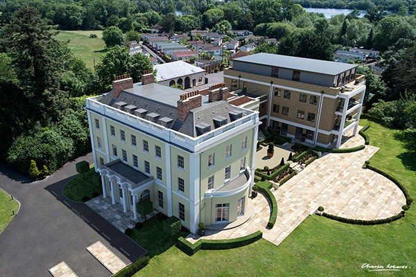
The first aerial view presented the development from a higher, more strategic vantage point. This helped show the relationship between the proposed homes and the wider surrounding context, including adjacent roads, open fields and nearby residential clusters. From this angle, the development could be read as part of a larger landscape pattern. It clearly showed that the site was not isolated, but part of an existing settled environment. The viewer could understand its access, its boundaries and its relationship to the countryside beyond.
The second aerial view brought the development slightly closer and from a different direction, helping reveal more of the internal character of the scheme. This image showed how the homes were arranged, how gardens and boundaries worked, and how the planting strategy helped soften the development into the landscape. It also gave a stronger sense of hierarchy across the site, with the road layout and plot arrangement reading more clearly.
Together, the pair of visuals gave a rounded understanding of the proposal. One emphasised context and placement. The other focused more closely on layout and character. This is a particularly effective strategy in aerial CGI because it avoids relying on a single hero image to do all the work.
Showing the Transformation of a Former Garden Centre
One of the most important roles of the CGI was to demonstrate transformation. Former garden centre sites often have excellent redevelopment potential, but they are not always visually coherent in their existing state. They may include leftover buildings, service yards, worn surfaces and an overall appearance that no longer reflects the best use of the land. For a viewer who does not know the design intent, it can be difficult to imagine how such a site could become a high-quality residential environment.
The aerial CGI changed that completely. It took a site with a previous commercial identity and reimagined it as a carefully structured neighbourhood of homes set within generous greenery. That transformation was powerful because it was visible. Rather than asking viewers to interpret planning drawings and mentally piece together the outcome, the images did that work for them.
This is often where property CGI adds the greatest value. It allows a proposal to be judged on its merits as a finished place rather than on the limitations of the current site condition. That can be enormously helpful for planning discussions, stakeholder presentations and development marketing, where first impressions matter.
Landscape, Maturity and Sense of Place
A major strength of these visuals was the way they treated the surrounding landscape. The development was not shown as a hard-edged estate dropped into open land. Instead, it was presented as something shaped by its context. Mature trees, hedgerows, retained boundaries and soft planting all contributed to a much more believable and attractive outcome.
This is especially important on edge-of-settlement or semi-rural sites. Landscape is often one of the key concerns in both planning and public perception. If a development looks exposed, over-engineered or disconnected from its surroundings, it can quickly feel out of place. If, however, it appears nestled into existing greenery, with a strong planted framework and careful boundaries, it feels more considered and more natural.
The aerial views in this case captured that beautifully. They showed the homes sitting within a green matrix rather than standing apart from it. Gardens felt generous. Trees created depth and maturity. Boundary lines were legible but not harsh. The overall message was clear: this was not simply a development on a former garden centre site, but a proposal for a residential environment that respected and built upon the landscape qualities already present.
Supporting Planning and Consultation
Aerial drone property CGI is often particularly valuable during planning and consultation because it helps explain complex proposals quickly and clearly. This project was a good example of that. A site with an unusual previous use, a broad landscape setting and multiple dwellings can generate a lot of questions. How visible will it be? How dense will it feel? How will it relate to nearby homes? Will it sit comfortably within the area?
These are all questions that aerial CGI can help answer. The visuals created for this scheme supported a clearer discussion around scale, context and design intent. They showed that the development was not overbearing, that it retained a strong landscape presence, and that the layout had been carefully considered. For planning officers, consultants and local stakeholders, that kind of clarity can be extremely helpful.
Of course, CGI is not a substitute for technical planning documents, but it works exceptionally well alongside them. It provides the accessible layer of communication that allows the rest of the information to be understood in context.
Marketing Benefits Beyond Planning
Although these visuals may have been valuable at planning stage, their usefulness does not end there. Aerial property CGI also has strong marketing value. Once a development begins moving forward, the same images can help support brochures, websites, investor presentations and off-plan sales material.
The reason is simple. Buyers and investors respond strongly to context. They want to understand not just what a house looks like, but where it sits and what surrounds it. Aerial visuals answer those questions immediately. They show the broader setting, the arrangement of plots, the amount of greenery and the character of the development as a whole. That makes them extremely effective in early-stage marketing, when the physical site may not yet reflect the quality of the finished scheme.
For a former garden centre site in particular, this is especially useful. Without CGI, a prospective buyer might struggle to picture the future environment. With it, they can understand the quality and positioning of the homes from the outset.
The Value of Drone Photography in Property CGI
Using real drone photography as the foundation for the visualisation also adds a level of authenticity that purely synthetic aerial views often cannot match. The real landscape, road network, neighbouring buildings and mature vegetation are all already present in the photograph. When the CGI is integrated properly, the result feels immediate and believable.
That authenticity is one of the great strengths of drone property CGI. It combines the realism of real-world context with the flexibility of architectural visualisation. For Charles Roberts Studios, this approach allows us to produce visuals that are not only visually impressive but also genuinely useful. They help people understand what is proposed in a truthful and engaging way.
In this project, the drone base imagery did a huge amount of work. It located the development within a recognisable setting and gave weight to the CGI proposal. It showed the surrounding countryside, the established vegetation and the neighbouring properties exactly as they are. Onto that, the proposed development could be layered with precision and clarity.
Conclusion
This former garden centre project is a strong example of how aerial drone property CGI can unlock the potential of a site and communicate a development vision with real impact. By combining high-resolution drone photography with carefully integrated CGI architecture and landscaping, Charles Roberts Studios was able to show how an underused site could be transformed into a high-quality residential setting.
The final images did more than make the scheme look attractive. They explained its structure, revealed its context, highlighted its landscape setting and helped viewers understand the proposal as a complete place. That is the true value of aerial CGI. It turns plans into something people can immediately see and understand.
For developments on complex, previously used or visually sensitive sites, that level of communication can be invaluable. Whether for planning, consultation, marketing or investor presentations, aerial drone property CGI gives a project clarity, confidence and a far stronger chance of being understood on its best terms.
More work

























Contact

20-22 Wenlock Road
London
N1 7GU
Chat on WhatsApp
[email protected]
+44 (0) 203 026 7100
USA Site
Follow Us
Sectors
Studio
Copyright © 1995 -
All rights reserved